Evergreen Lake
Evergreen Lake Watershed Plan
Evergreen Lake TMDL Executive Summary
Watershed Improvement Projects
How to get involved
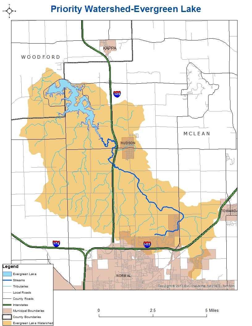
The Evergreen Lake watershed encompasses 41.1 square miles or 25,730 acres in McLean and Woodford Counties in central Illinois. Agriculture and pasture land are the predominant land uses. Row crops cover 87% of the watershed. The Village of Hudson and the far north edge of the Town of Normal are included in the watershed. Since 1989, the Town of Normal has converted almost 1,000 acres of agricultural lands to urban residential areas in the upper reaches of Six Mile Creek, which is one of the two major tributaries to Evergreen Lake. Evergreen lake was constructed in 1971 as a supplemental water supply for the City of Bloomington. In 1995, Evergreen Dam was raised five feet, increasing storage capacity by 36%. Water from Lake Evergreen is pumped to Lake Bloomington for treatment. The lake itself covers 900 acres and has 22.5 miles of shoreline.
The Evergreen Lake watershed plan was developed by the Evergreen Lake Watershed Planning Committee. The City of Bloomington, Pheasants Forever, and the McLean County Soil & Water Conservation District (SWCD) have provided funds for filter strips along waterways in both the Evergreen Lake and Lake Bloomington watersheds. The McLean County SWCD has promoted and assisted with willow plantings to help stabilize banks and limit sediment from entering the lake. The City of Bloomington has installed some erosion control measures around Evergreen Lake and plans to implement extensive shoreline stabilization measures, possibly to include riprap and plantings.